
 |
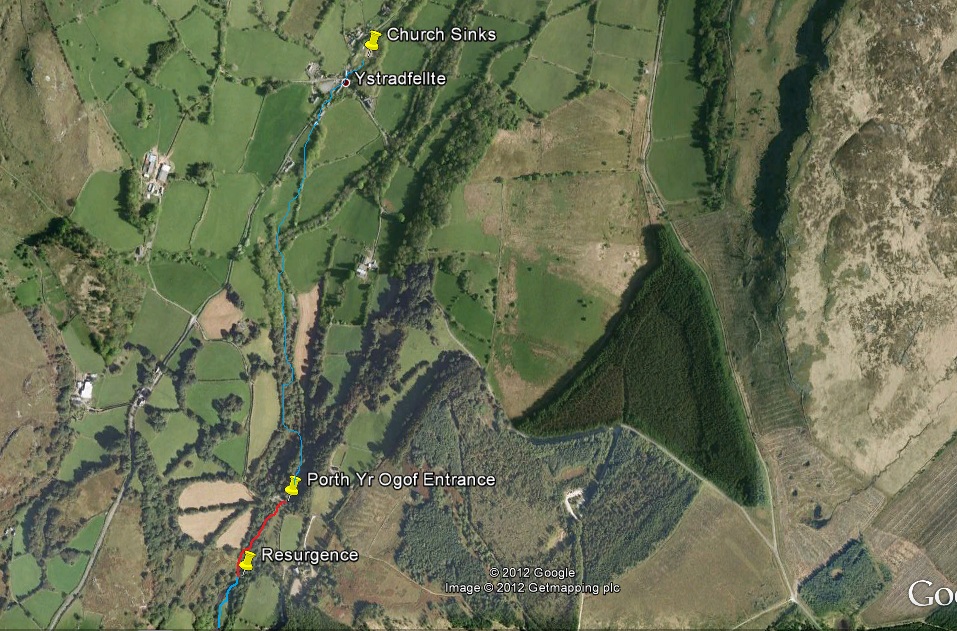
| Map showing the river course from Ystradfellte, through Porth Yr Ogof and downstream |
The Mellte is formed by the confluence of two rivers: The Afon Llia and Afon Dringarth.

Downstream of Porth Yr Ogof, the river flows over several impressive waterfalls, three of which are called Sgwd Clun Gwyn, Sgwd Isaf Clun Gwyn and Sgwd y Pannwr.
Much of the river valley has been designated a Site of Special Scientific Interest
River level data can be viewed at the Environment Agency website for the Mellte and Project Baseline has been granted access to historical data.The Environment Agency produce up todate river levels data, which is essential for dive planning. Porth is only diveable in the lowest of water levels. High water levels or flash flooding leads to strong currents combined with poor or zero visibility.

 These are some examples of the data they produce for the river Mellte.